


East Siang grim in silence while the River water level rises up
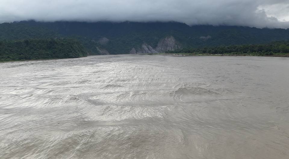
PASIGHAT: The flood situation in East Siang is one of those phenomena that brings a state of despondency to the citizens of Pasighat and her adjoining villages lying in the vicinity of the river. Not an unprecedented one but still it continues to remain grim, with river Siang rising above the danger level, causing floods and soil erosion in various parts of the district. The authorities are worried by the volume and turbulence of Siang’s water as the affected people are struggling to reach higher, safer grounds and salvaging their belongings.
The DDMO of Pasighat said the water level of Siang is rising due to incessant rain and flowing 0.60 cm above the danger mark (153.96 metres) at Pasighat. About 150-200 metres of National Highway-13, starting from Siluk War Memorial, have partially submerged in floodwater, threatening to eat away the edges of the road.
According to the office of the Mebo ADC, about 10 metres of land along the left bank of Siang has been eroded at Sigar, washing away the boundary spurs built by the community on a self-help basis. These were constructed to protect the old playground, Garak river banks and graveyard boundary.
Recently news portals of the SPACE media had also reported that the Gabion across the Siang river beside the embankment at Paglek village and Komli-Ghat are on the verge of collapse. The authorities need to dive in and make sure to motivate the denizens to work unitedly for the town and its people.

Tags:
What's Your Reaction?